Enhance your organising strategy with the latest version of Mapped
That’s why we built Mapped — a digital platform made by and for organisers. Mapped turns static membership lists into live, shared maps that help you see where your people are, plan strategically and take collective action. We’ve just launched a new version of Mapped, rebuilt from the ground up to make it faster, smoother and easier to use.
Why it matters
Whether you’re planning an election push, organising a direct action, or growing your supporter base, location matters . Mapped helps you:
- See where your members and supporters are
- Identify gaps and strongholds
- Coordinate action across your campaign
- Share a clear picture with the rest of your team
You don’t need to be a tech expert — just connect your existing membership database or upload a spreadsheet. Mapped instantly visualises your data on an interactive map. From there, you can:
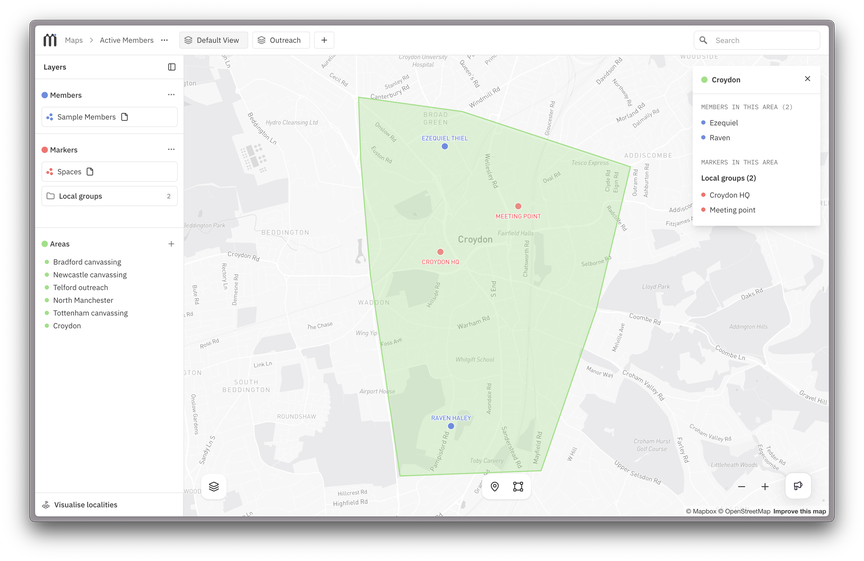
- Add markers for local hubs, groups or targets
- Define areas for leafleting, canvassing or outreach
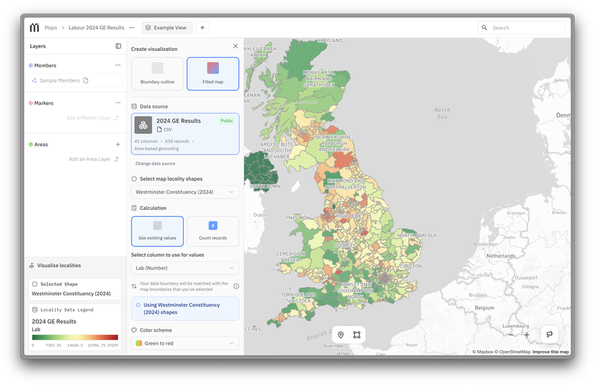
- Overlay different boundary data like constituencies or Census Output Areas
- Colour-code areas based on election results, demographics or other data sources
The result: a living map your group can actually use to make decisions together.
Real-world use cases
Here are just a few ways organisers are already using Mapped:
- Spot where your campaign has the most supporters by constituency, overlaid with up-to-date polling data
- Find everyone within a kilometre of a target location, then contact them to take part in an action
- Draw the boundary of the apartheid free zone you’re organising, and mark businesses to reach out to within it
- Create a shared map of low-cost, accessible venues for meetings in your city
You can also use powerful new filters to select people by location — for example, everyone living near a specific target or inside a campaign boundary — and sync that list straight back to your database for outreach.
What’s next
Mapped is built around three pillars: Strategise, Collaborate and Contribute . We’ve focused this release on strategising — giving groups the tools to ground their organising in shared, visual information. Next up, we’re building features that make collaboration between groups easier and safer.
Coming soon:
- Public Maps — create a public version of any map to share with supporters and allies.
- More integrations — Mapped already works with Action Network, Airtable, Google Sheets and Mailchimp. Next, we’re adding Baserow and NationBuilder.
- Collaboration tools — to allow seamless collaboration between allied organisations.
- Expanded Movement Data Library — including more geographic boundaries (like councils and wards) and more economic, demographic and political datasets.
This is just the beginning. Our aim is to make mapping accessible and easy to progressive organisers throughout the UK.
Try it out
For now, access to Mapped is by request. If your group wants to try it out, fill out this form to get started. Mapped is built with movements, not just for them. If you use it, we’d love to hear what works for your organising and what doesn’t. Your feedback will shape what we build next.